Mountain
Approach
Through collaborative planning and a site visit in the fall of 2019, IMBA Trail Solutions has crafted this master plan to define the opportunities and constraints in developing trails on the Unaka Bike Park property inside the town of Erwin, TN. To gain a comprehensive understanding of the area and the potential of the trail system, Trail Solutions assessed terrain, slopes, existing infrastructure, and ecology. Every detail was examined, from soil types—which can affect trail tread compaction and erosion potential—to anticipated user numbers and trailhead needs. Regionally- and globally-experienced trail specialists gauged which established practices they would use and which of the latest innovations they could employ. These trail specialists ride similar trails in the region and understand the area’s outdoor culture. They interviewed local stakeholders to learn from their expertise, balancing the interests of community members and land managers in designing trail systems.
Project Background
This trail system will capitalize on the growing regional demand for trails, specifically those that are optimized for mountain biking. It will serve the needs of the community by providing opportunities for a wide range of users to improve their physical health and experience the outdoors, as well as promote economic development through adventure tourism. Proximity to local schools, downtown, and Interstate 26 provide unique circumstances for significant benefits from trail development.
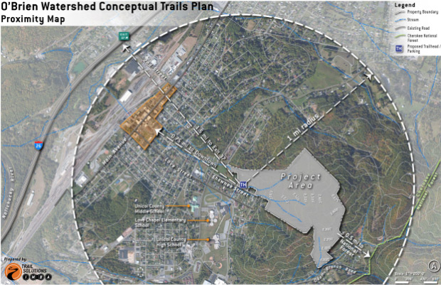
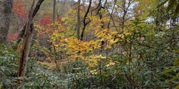
The Unaka Bike Park Property
The project site has long been the water supply watershed for the town of Erwin. The site has amazing proximity to key landmarks and is located less than two blocks from the school complex, under a mile from downtown, and just over a mile from exit 37 on I-26. This creates a unique opportunity for connectivity to the community and a great way to showcase a modern trail system and downtown to visitors. The watershed abuts Shawnee Street at two locations, with a few private homes separating the road frontage. On its southern edge, the property comes close to Banner Road but does not directly abut the road.
Goals and Objectives
The goal of the Unaka Bike Park plan is to develop a progressive network of trails that offers beginner- to advanced-level mountain biking as well as pedestrian opportunities. This includes multiuse and bike-optimized trails and bike-specific skill areas. As trails are developed and mileage increases, visitation from residents, visitors, and regional trail users will increase. The new trails will be bike-optimized, with careful consideration to meet the needs of hikers and runners as well and a future gateway connecting to the Cherokee National Forest.
The objectives of the high-quality trails master plan are:
- Increase the availability of mountain bike-optimized trails and hiking trails in the region.
- Ensure a wide variety of difficulty levels are represented.
- Lay the groundwork for a successful trail system that appeals to a wide spectrum of visitors.
- Develop amenities that help riders build mountain bike skills and provide opportunities for progressive challenge and growth.
- Offer a network of trails that supports National Interscholastic Cycling Association training.
- Provide the quality and quantity of experiences in the system to create a regionally-significant trail destination that merits a half-day drive to the area.
- Create a trail system that is environmentally- and socially-sustainable highlights the natural beauty of the Appalachian Mountains and Unicoi County region.
- Identify phases of implementation to offset financial burden and ensure high-quality trails are developed over time to appeal to the community and visitors.

Proposed Layout of the Unaka Bike Park
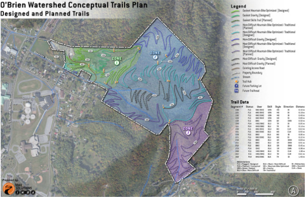
The current master plan proposes that the Unaka Bike Park be developed into three unique “zones” with experiences and features that take advantage of the natural beauty and resources available on the property. The zones have been mapped and designed as follows.

Update to Park Plan
Throughout construction of the park, a more intimate understanding of the property layout and dirt conditions provided the opportunity for a revision. In 2023 the Friends of O’Brien deployed Barry Smith Trails to update the master park plan with additional trails and altered layout.
The Trailhead
The planned trailhead is located off of Shawnee Street, which provides excellent connectivity to the school complex and downtown Erwin. Wayfinding signage is recommended to direct visitors—especially from downtown—to the trailhead. Additionally, a bike lane or path from downtown to the trailhead should be considered in long-term plans to increase the viability of visitors parking in Erwin and riding to the trails. This reduces the need for parking at the trails and, more importantly, makes it much easier for trail users to visit local businesses, restaurants, and watering holes before and after rides.
The proposed trailhead location has ample room for a parking lot with up to 30 car spaces, which is anticipated to meet the needs for the planned trail system. The trailhead should contain a number of typical infrastructure amenities beyond a parking lot, including:
- Kiosk with trail map, trail system rules and regulations, and important information.
- Pavilion or shade structures. This can be accomplished through careful low impact design that saves large hardwood shade trees.
- Changing facilities to provide visitors a private space to put on and take off mountain bike gear.
- Bathroom and changing facilities. If no potable water is plumbed to the trailhead, then portable toilets are recommended.
The trailhead’s location near private residences and a residential street will help deter illegal activity.
The trailhead’s large, flat valley bottom is ideal for other recreational infrastructure. Because a trail system is the central goal with mountain biking as the focus, it is recommended that additional amenities be concentrated on building riders’ skills.
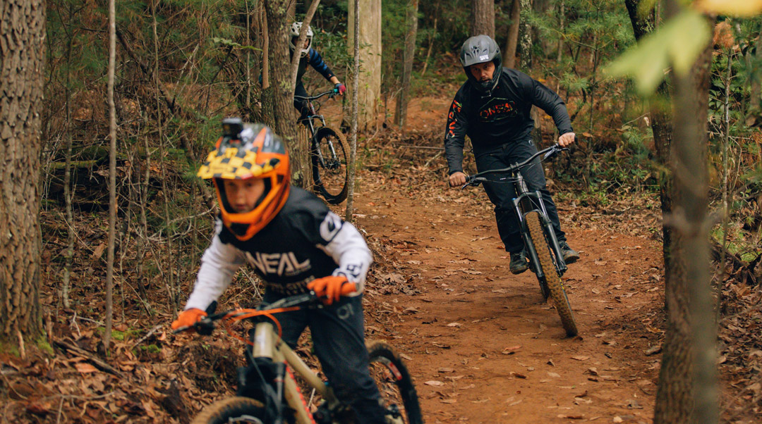
Progression is vital to mountain biking and unique to the sport in many ways. People learn best when they can practice skills and watch others who have mastered them. The trailhead location will provide a skills practice area, especially for children and new riders. Skills features, whether prefabricated or natural (such as rock) will be developed to provide excellent opportunities to work on balance, power, bike handling, and technical moves. A short skills loop will be close to the attentive eyes of parents, who could relax at nearby picnic tables or in the shade. This type of facility is widely popular and growing in demand. Additionally, a small tot track may be added, which could provide greater skill building and enjoyment for young riders. A tot track, much like a pump track, is a small series of rollers and berms that teach proficient “pumping” and weight transfer—skills which increase the fun on trails and are necessary for various maneuvers.
Zone 1: Beginner
Gomer’s Loop – This green cross-country loop is the gateway to the park. From Gomer’s Loop, riders can access gravity trials within the lower section of the park and also branch off to the upper sections of the park.
Ankle-biter – This green gravity trail is designed to give riders of all skill levels a fun way to flow downhill. With no mandatory jumps or drops and gently sweeping berms, Ankle-biter is a great way for new and young riders to discover the joys of gravity trails.
Roli Noli – With table-top jumps and log booters, this blue gravity trail is a great testing ground for those learning how to get in the air.
Zone 2: The North Slope
Crawl Bear – This blue climb trail is your ticket to the upper sections of the park with views down into Erwin. Don’t want to go all the way to the top? No problem. This trail is bi-directional. So, feel free to enjoy the ride back down.
Traverse – This will be your connector throughout the upper sections of the park. As of now, it links Crawl Bear to Moonsault.
Moonsault – This is our signature blue gravity trail. Moonsault is high speed with jumps, drops, and high banked berms. If you’re looking for flow and air, this is your trail.
Zone 3: South Slope
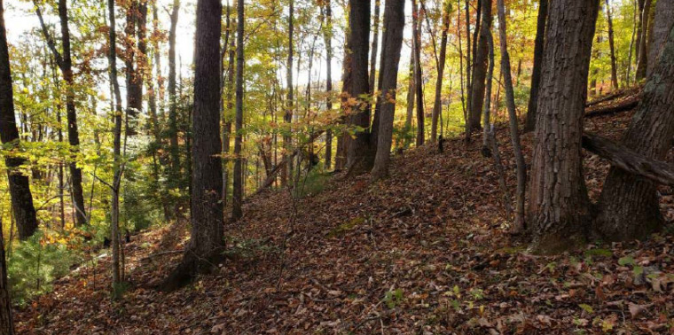
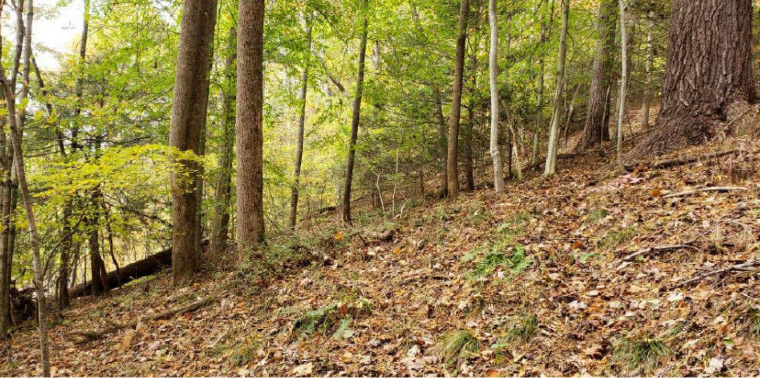
Zone 3 occupies the remainder of the site—the southern slope from the ridge saddle down toward Odom Branch Road. The entire zone is almost 20 acres in size. Zone 3 is the driest zone on the project site, with more sparse vegetation cover than the other sites. This also provides the best views on the site, looking up Odom Branch towards the Cherokee National Forest and across the valley. There is one main stream on this side, which creates a small drainage valley. An existing old road marks the western property line. Surveyor paths are evident in some places.
Zone 3 offers the most remote experience on the site with the ridge blocking Erwin and I-26; however, neighborhood sounds on Odom Branch Road can be heard occasionally. The slopes are more moderate than the steep slopes found in Zone 2. Like Zone 2, this zone showed little evidence of exposed rocks during the planning site visit.
Zone 3’s usable elevation is similar to Zone 2, almost 500 feet from the saddle to the lowest recommended point for trail development. Currently, the property comes close to Banner Road but does not abut it; therefore, the only access is the proposed trailhead near Zone 1. Near the lower property line are a few small rock shelves above Odom Branch, most of them off the property, with a few possibly usable for trail development.
If you would like more information or specific details about the Unaka Bike Park project, feel free to CONTACT US. We are currently seeking investment partners and donations to help bring this project to reality, and would appreciate your consideration for DONATIONS to help us grow Unicoi County’s outdoor adventure resources.